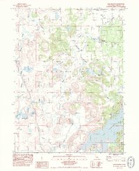
1984 Map of Lake Shastina
USGS Topo · Published 1984About this map
Big Springs and the surrounding irrigation network define this 1984 survey of the Shasta Valley landscape. The map captures a moment when traditional ranching infrastructure, evidenced by numerous wells and a complex system of ditches and sloughs like McCloud Slough, coexists with newer residential and recreational developments around the southern shores of Lake Shastina. A local hub of activity is centered at the Big Springs Sch and the Four Corners intersection, serving the rural community north of the reservoir. Notable for local historians and aviation researchers is the site of the Dismantled Seattle/SF Airway Beacon No 27, a relic of early commercial flight paths. The terrain is marked by distinctive geological features such as Hole in the Ground and Juniper Flat, while newer additions like the Golf Course and residential streets like Rainbow Drive signal the area's late 20th-century evolution.
Find a feature on this map
31 named features on this map. Tap any name to fly to it.
Don’t see what you’re looking for? This feature index may not catch every label — zoom into the map to look around manually.
Map Details
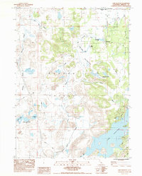
Editions of this 1984 Lake Shastina Map
2 editions found
Other maps of this area

1886 · Shasta
USGS Topo · 1:250,000

1894 · Shasta
USGS Topo · 1:250,000

1921 · Shasta Valley Sheet No 7
USGS Topo · 1:24,000

1921 · Shasta Valley Sheet No 11
USGS Topo · 1:24,000

1921 · Shasta Valley Sheet No 1
USGS Topo · 1:24,000

1921 · Shasta Valley Sheet No 6
USGS Topo · 1:24,000

1921 · Shasta Valley Sheet No 2
USGS Topo · 1:24,000

1922 · Shasta Valley Sheet No 10
USGS Topo · 1:24,000

1922 · Shasta Valley Sheet No 1 S
USGS Topo · 1:24,000

1922 · Shasta Valley Sheet No 9
USGS Topo · 1:24,000