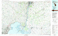
1981 Map of Lake St. Clair North
USGS Topo · Published 1981About this map
The complex international boundary along the St Clair River and the northern reaches of Lake St Clair defines this borderland region. The map highlights the intricate delta of the St Clair Flats State Wildlife Area, where the river splits into the North Channel, Middle Channel, and South Channel around Harsens Island and Walpole Island. This unique ecosystem sits alongside industrial and military hubs, including Selfridge Air Force Base and the twin cities of Port Huron and Sarnia. On the Canadian side, the landscape is shaped by the Sydenham River and historical settlements like Oil Springs, while the Michigan shore is densely lined with communities from St Clair Shores to New Baltimore. The presence of the Sarnia Indian Reserve and Walpole Island Indian Reserve underscores the long-standing indigenous geography of the waterway.
Find a feature on this map
88 named features on this map. Tap any name to fly to it.
Don’t see what you’re looking for? This feature index may not catch every label — zoom into the map to look around manually.
Map Details
Editions of this 1981 Lake St. Clair North Map
This is the sole edition of this map. No revisions or reprints were ever made.
Other maps of this area

1905 · Detroit
USGS Topo · 1:62,500

1905 · Grosse Pointe
USGS Topo · 1:62,500

1908 · Rochester
USGS Topo · 1:62,500

1912 · Mt Clemens
USGS Topo · 1:62,500

1912 · Port Huron
USGS Topo · 1:62,500

1914 · Armada
USGS Topo · 1:62,500

1914 · Algonac
USGS Topo · 1:62,500

1918 · Detroit
USGS Topo · 1:62,500

1918 · Grosse Pointe
USGS Topo · 1:62,500

1924 · Detroit
USGS Topo · 1:62,500