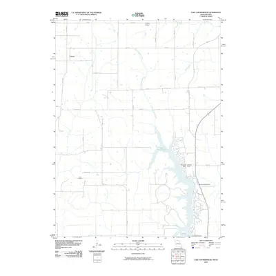
2010 Map of Lake Thunderhead
USGS Topo · Published 2010About this map
Genoa sits in the northwest corner of this landscape, marking a rural community defined by a grid of county roads and meandering waterways. The map is dominated by the sprawling waters of Lake Thunderhead, created by the Lake Thunderhead Dam along North Blackbird Creek. This substantial reservoir, featuring a complex shoreline of inlets and residential development, represents a significant transformation of the local hydrography compared to the smaller Unionville Reservoir and Lake Mahoney Dam to the south. Local heritage is preserved at Livingston Cemetery and Union Cemetery, while the Municipal Unionville Airport Airport serves the transportation needs of the region. The map captures the transition from traditional Iowa farmland to more modern recreational and utility infrastructures.
Find a feature on this map
31 named features on this map. Tap any name to fly to it.
Don’t see what you’re looking for? This feature index may not catch every label — zoom into the map to look around manually.
Map Details
Editions of this 2010 Lake Thunderhead Map
This is the sole edition of this map. No revisions or reprints were ever made.
Other maps of this area

1912 · Green City
USGS Topo · 1:62,500

1914 · Green City
USGS Topo · 1:62,500

1939 · Centerville
USGS Topo · 1:62,500

1941 · Centerville
USGS Topo · 1:62,500

1942 · Seymour
USGS Topo · 1:62,500

1944 · Seymour
USGS Topo · 1:62,500

1954 · Centerville
USGS Topo · 1:250,000

1957 · Centerville
USGS Topo · 1:250,000

1958 · Centerville
USGS Topo · 1:250,000

1964 · Pollock NW
USGS Topo · 1:24,000