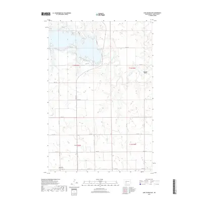
2018 Map of Lake Tschida East
USGS Topo · Published 2018About this map
Lake Tschida dominates the northern landscape of this Grant County region, where the Heart River winds through the prairie before reaching the reservoir. The topography is defined by the sharp descent from the high plains into the river valley, a transition marked by numerous coulees and seasonal drainages like Heart-Butte Cr. Cultural and family history centers on the Hope Lutheran (Old Stone) Cem in the southern portion of the sheet, providing a primary point of reference for genealogists. The map also captures the seasonal and recreational character of the lake shoreline, identifying access points like Cabin Area 3 and Flamingo Ln, while the presence of Johnson Ford further east indicates an established river crossing point used long before modern road improvements.
Find a feature on this map
24 named features on this map. Tap any name to fly to it.
Don’t see what you’re looking for? This feature index may not catch every label — zoom into the map to look around manually.
Map Details
Editions of this 2018 Lake Tschida East Map
This is the sole edition of this map. No revisions or reprints were ever made.
Other maps of this area

1938 · Heart Butte
USGS Topo · 1:48,000

1944 · Heart Butte
USGS Topo · 1:62,500

1954 · Bismarck
USGS Topo · 1:250,000

1958 · Bismarck
USGS Topo · 1:250,000

1960 · Heart Butte NW
USGS Topo · 1:24,000

1960 · Heart Butte
USGS Topo · 1:24,000

1980 · Crown Butte Creek NW
USGS Topo · 1:24,000
1980 · Lake Tschida East
USGS Topo · 1:24,000

1980 · Heil
USGS Topo · 1:24,000

1980 · Crown Butte Creek SW
USGS Topo · 1:24,000