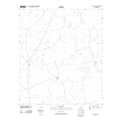
2010 Map of Lake Victor
USGS Topo · Published 2010About this map
Lake Victor sits at the heart of this Central Texas landscape, where the headwaters of the North Fork San Gabriel River meet a network of rural county roads and historic trails. The map documents a transition between open ranch land and the dissected terrain of McCain Hollow, revealing a region shaped by its drainage systems like South Mesquite Creek and Allen Branch. This 2010 survey provides essential data for genealogists tracing family roots in Burnet County, as it precisely locates several burial grounds including Tumlinson Cemetery, Couble Cemetery, and Dobyville Cemetery. The presence of the Deer Pasture Airport and the smaller settlement of Sunnylane illustrate the contemporary rural character of the area, while long-established thoroughfares such as the Lampasas-Burnet Rd and Old Austin Rd show how transport patterns have persisted through the decades.
Find a feature on this map
24 named features on this map. Tap any name to fly to it.
Don’t see what you’re looking for? This feature index may not catch every label — zoom into the map to look around manually.
Map Details
Editions of this 2010 Lake Victor Map
This is the sole edition of this map. No revisions or reprints were ever made.
Other maps of this area

1887 · Lampasas
USGS Topo · 1:125,000

1887 · Burnet
USGS Topo · 1:125,000

1893 · Burnet
USGS Topo · 1:125,000

1894 · Lampasas
USGS Topo · 1:125,000

1903 · Burnet
USGS Topo · 1:125,000

1909 · Burnet
USGS Topo · 1:125,000

1932 · Tow
USGS Topo · 1:62,500

1954 · Brownwood
USGS Topo · 1:250,000

1954 · Lampasas
USGS Topo · 1:62,500

1954 · Lampasas
USGS Topo · 1:24,000