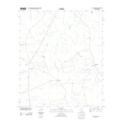
2012 Map of Lake Victor
USGS Topo · Published 2012About this map
Lake Victor sits at the heart of this Burnet County landscape, where the headwaters of the N Fork San Gabriel River begin their southeastward flow. The area's settlement history is etched into the terrain through a high concentration of small family and community burial grounds, including the Tumlinson Cem, Dobyville Cem, and the Caubr Cemetery. The rural road network, defined by routes like FM-2340 and Rocky Creek Ranch Rd, connects these quiet locales with agricultural holdings and the small settlement of Sunnylane to the east. Topographically, the land is carved by numerous drainages such as S Mesquite Cr and N Rocky Cr, creating a series of hollows like McCain Hollow and Scott Hollow. This survey provides a clear view of the modern ranching and residential patterns that characterize this part of the Texas Hill Country fringe in the early 21st century.
Find a feature on this map
31 named features on this map. Tap any name to fly to it.
Don’t see what you’re looking for? This feature index may not catch every label — zoom into the map to look around manually.
Map Details
Editions of this 2012 Lake Victor Map
This is the sole edition of this map. No revisions or reprints were ever made.
Other maps of this area

1887 · Lampasas
USGS Topo · 1:125,000

1887 · Burnet
USGS Topo · 1:125,000

1893 · Burnet
USGS Topo · 1:125,000

1894 · Lampasas
USGS Topo · 1:125,000

1903 · Burnet
USGS Topo · 1:125,000

1909 · Burnet
USGS Topo · 1:125,000

1932 · Tow
USGS Topo · 1:62,500

1954 · Brownwood
USGS Topo · 1:250,000

1954 · Lampasas
USGS Topo · 1:62,500

1954 · Lampasas
USGS Topo · 1:24,000