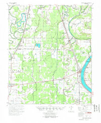
1955 Map of Lake Village
USGS Topo · Published 1955About this map
The crescent curve of Lake Chicot dominates this mid-century survey of the Arkansas Delta, where the Chicot County Courthouse anchors the seat of Lake Village. This landscape is defined by its complex hydrology, featuring the Boeuf River, Bartholomew Bayou, and Macon Bayou, which weave through a grid of agricultural land and drainage canals like Canal No. 43. The Missouri Pacific railroad corridor serves as a primary transit axis, connecting small rural centers such as Jerome, Montrose, and Boydell.
Find a feature on this map
98 named features on this map. Tap any name to fly to it.
Don’t see what you’re looking for? This feature index may not catch every label — zoom into the map to look around manually.
Map Details
Editions of this 1955 Lake Village Map
2 editions found

Other maps of this area

1933 · Lamont
USGS Topo · 1:62,500

1935 · Mist
USGS Topo · 1:62,500

1935 · Wilmot
USGS Topo · 1:62,500

1935 · Cominto
USGS Topo · 1:62,500

1936 · McGehee
USGS Topo · 1:62,500

1936 · Eudora
USGS Topo · 1:62,500

1936 · Lake Village
USGS Topo · 1:62,500

1937 · McGehee
USGS Topo · 1:62,500

1939 · Readland
USGS Topo · 1:62,500

1939 · Refuge
USGS Topo · 1:62,500