
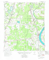
1955 Map of Lake Village
USGS Topo · Published 1955About this map
Lake Chicot dominates the eastern edge of this mid-century survey, its distinctive oxbow shape cradling the town of Lake Village and the Chicot County Courthouse. The landscape is a complex network of bayous and drainage improvements, including the Diversion Canal No. 1 and West Boggy Bayou, reflecting the intense water management required for the region's agricultural economy. This era shows the Missouri Pacific Railroad threading through several small rural junctions such as Jerome, Montrose, and Boydell.
Find a feature on this map
92 named features on this map. Tap any name to fly to it.
Don’t see what you’re looking for? This feature index may not catch every label — zoom into the map to look around manually.
Map Details
Editions of this 1955 Lake Village Map
2 editions found
Other maps of this area

1933 · Lamont
USGS Topo · 1:62,500

1935 · Mist
USGS Topo · 1:62,500

1935 · Wilmot
USGS Topo · 1:62,500

1935 · Cominto
USGS Topo · 1:62,500

1936 · McGehee
USGS Topo · 1:62,500

1936 · Eudora
USGS Topo · 1:62,500

1936 · Lake Village
USGS Topo · 1:62,500

1937 · McGehee
USGS Topo · 1:62,500

1939 · Readland
USGS Topo · 1:62,500

1939 · Refuge
USGS Topo · 1:62,500