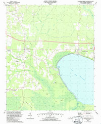
1987 Map of Lake Waccamaw West
USGS Topo · Published 1987About this map
The swampy lowlands of Columbus County define this landscape, where the waters of Lake Waccamaw meet the meandering path of the Waccamaw River. Settlement patterns follow the elevated corridors along the Seaboard System railroad, connecting the communities of Hallsboro, Artesia, and Wananish. The map reveals a deeply rooted rural society characterized by numerous family and community landmarks, including Mount Olive Ch, New Light Ch, and Honey Hill Ch.
Find a feature on this map
49 named features on this map. Tap any name to fly to it.
Don’t see what you’re looking for? This feature index may not catch every label — zoom into the map to look around manually.
Map Details
Editions of this 1987 Lake Waccamaw West Map
This is the sole edition of this map. No revisions or reprints were ever made.
Other maps of this area

1942 · Juniper Creek
USGS Topo · 1:24,000

1943 · Nakina
USGS Topo · 1:24,000

1953 · Florence
USGS Topo · 1:250,000

1954 · Florence
USGS Topo · 1:250,000

1954 · Bolton
USGS Topo · 1:62,500

1955 · Whiteville
USGS Topo · 1:62,500
1986 · Lake Waccamaw East
USGS Topo · 1:24,000
1986 · Council
USGS Topo · 1:24,000

1986 · Whiteville
USGS Topo · 1:100,000
1987 · Clarkton
USGS Topo · 1:24,000