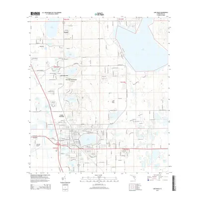
2015 Map of Lake Wales
USGS Topo · Published 2015About this map
Iron Mtn rises as a prominent landmark north of Lake Wales, anchoring a landscape defined by an extraordinary concentration of freshwater lakes and citrus-belt settlements. This 2015 survey reveals the intricate topography of the Lake Wales Ridge, where residential developments like Lake of the Hills and Mountain Lake Station are interspersed with numerous named water bodies, including Lake Starr, Lake Mabel, and the expansive Lake Pierce. To the north, the town of Dundee sits near Lake Annie, while the western edge of the map follows the Peace Cr Drainage Canal. The presence of the Lake Wales Municipal Airport and the Garden Cem provides specific points of interest for local historians and genealogists tracing the modern growth of these Polk County communities.
Find a feature on this map
112 named features on this map. Tap any name to fly to it.
Don’t see what you’re looking for? This feature index may not catch every label — zoom into the map to look around manually.
Map Details
Editions of this 2015 Lake Wales Map
This is the sole edition of this map. No revisions or reprints were ever made.
Other maps of this area

1952 · Lake Wales
USGS Topo · 1:24,000

1952 · Babson Park
USGS Topo · 1:24,000

1952 · Hesperides
USGS Topo · 1:24,000

1952 · Lake Weohyakapka
USGS Topo · 1:24,000

1953 · Dundee
USGS Topo · 1:24,000

1953 · Lake Hatchineha
USGS Topo · 1:24,000

1955 · Eloise
USGS Topo · 1:24,000

1955 · Alturas
USGS Topo · 1:24,000

1955 · Orlando
USGS Topo · 1:250,000

1956 · Fort Pierce
USGS Topo · 1:250,000