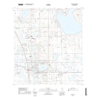
2018 Map of Lake Wales
USGS Topo · Published 2018About this map
The city of Lake Wales serves as the central hub of this Central Florida landscape, defined by an incredibly dense network of freshwater basins. From Lake Pierce in the northeast to Lake Altamaha and Lake Belle in the south, the topography is dominated by these enclosed water bodies, which have historically shaped the region's citrus and residential development. A prominent topographical feature, Iron Mountain, rises above the surrounding terrain, while the residential and commercial layout of Lake Wales shows a detailed grid around Crystal Lake and Lake Wales. Smaller communities like Waverly and Dundee are interconnected by a system of rural and improved roads including St Helena Rd and Masterpiece Rd. The presence of the Chalet Suzanne Air Strip and Lake Wales Municipal Airport highlights the area's aviation history, while the Garden Cemetery remains a significant local landmark for genealogical research.
Find a feature on this map
205 named features on this map. Tap any name to fly to it.
Don’t see what you’re looking for? This feature index may not catch every label — zoom into the map to look around manually.
Map Details
Editions of this 2018 Lake Wales Map
This is the sole edition of this map. No revisions or reprints were ever made.
Other maps of this area

1952 · Lake Wales
USGS Topo · 1:24,000

1952 · Babson Park
USGS Topo · 1:24,000

1952 · Hesperides
USGS Topo · 1:24,000

1952 · Lake Weohyakapka
USGS Topo · 1:24,000

1953 · Dundee
USGS Topo · 1:24,000

1953 · Lake Hatchineha
USGS Topo · 1:24,000

1955 · Eloise
USGS Topo · 1:24,000

1955 · Alturas
USGS Topo · 1:24,000

1955 · Orlando
USGS Topo · 1:250,000

1956 · Fort Pierce
USGS Topo · 1:250,000