
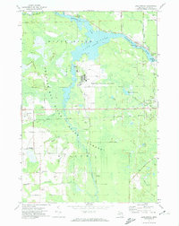
1971 Map of Lake Winyah
USGS Topo · Published 1974About this map
The Thunder Bay River winds through this Alpena County landscape, feeding the expansive Lake Winyah and the Fourmile Pond. This 1971 survey captures a region defined by its industrial and transportation infrastructure, where the Detroit and Mackinac Railroad cuts through the timberlands of the Mackinac State Forest. The settlement at Paxton and the nearby Kerston Station serve as small hubs along the rail line, while the Phelps Collins Airport occupies a significant portion of the central terrain.
Find a feature on this map
52 named features on this map. Tap any name to fly to it.
Don’t see what you’re looking for? This feature index may not catch every label — zoom into the map to look around manually.
Map Details
Editions of this 1971 Lake Winyah Map
2 editions found
Other maps of this area

1954 · Tawas City
USGS Topo · 1:250,000

1954 · Alpena
USGS Topo · 1:250,000

1957 · Alpena
USGS Topo · 1:250,000

1958 · Alpena
USGS Topo · 1:250,000

1958 · Tawas City
USGS Topo · 1:250,000

1969 · Alpena
USGS Topo · 1:250,000

1971 · Long Lake West
USGS Topo · 1:24,000

1971 · Alpena
USGS Topo · 1:24,000

1971 · Polaski
USGS Topo · 1:24,000

1971 · Lachine
USGS Topo · 1:24,000