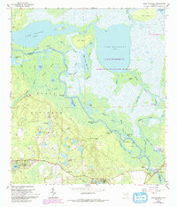
1962 Map of Lake Woodruff
USGS Topo · Published 1993About this map
St Johns River serpentines through a landscape dominated by the National Wildlife Refuge and the Ocala National Forest, defining the border between Volusia and Lake counties. This environment is characterized by an intricate network of waterways, including the massive Lake Woodruff and Lake Dexter, alongside numerous "dead rivers" and creeks like Tick Island Creek and Harrys Creek. The map documents the scattered human presence in this swampy terrain, from the small settlement of Saint Francis near the river's edge to the neighborhood of Lake Kathryn Heights in the southwest.
Find a feature on this map
63 named features on this map. Tap any name to fly to it.
Don’t see what you’re looking for? This feature index may not catch every label — zoom into the map to look around manually.
Map Details
Editions of this 1962 Lake Woodruff Map
3 editions found
Other maps of this area

1954 · Daytona Beach
USGS Topo · 1:250,000

1955 · Orlando
USGS Topo · 1:250,000

1957 · Orlando
USGS Topo · 1:250,000

1958 · Orlando
USGS Topo · 1:250,000

1958 · Daytona Beach
USGS Topo · 1:250,000

1962 · Orlando
USGS Topo · 1:250,000

1962 · Pine Lakes
USGS Topo · 1:24,000

1962 · Lake Woodruff
USGS Topo · 1:24,000

1964 · Daytona Beach
USGS Topo · 1:250,000
1964 · De Land
USGS Topo · 1:24,000