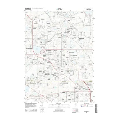
2015 Map of Lake Zurich
USGS Topo · Published 2015About this map
Lake Zurich anchors this 2015 study of the suburban landscape where Lake and Cook Counties meet. The area is characterized by a dense network of residential subdivisions and planned communities, many named for the numerous small glacial lakes such as Echo Lake, Forest Lake, and Sylvan Lake. This era shows significant suburban maturity, with extensive residential developments like Kildeer and Long Grove established alongside the older cores of Inverness and Barrington.
Find a feature on this map
150 named features on this map. Tap any name to fly to it.
Don’t see what you’re looking for? This feature index may not catch every label — zoom into the map to look around manually.
Map Details
Editions of this 2015 Lake Zurich Map
This is the sole edition of this map. No revisions or reprints were ever made.
Other maps of this area

1900 · Highwood
USGS Topo · 1:62,500

1906 · Waukegan
USGS Topo · 1:62,500

1908 · Waukegan
USGS Topo · 1:62,500

1920 · Grays Lake
USGS Topo · 1:62,500

1923 · Grays Lake
USGS Topo · 1:62,500

1923 · Barrington
USGS Topo · 1:62,500

1927 · Arlington Heights
USGS Topo · 1:24,000

1928 · Wheeling
USGS Topo · 1:24,000

1935 · Barrington
USGS Topo · 1:62,500
1953 · Arlington Heights
USGS Topo · 1:24,000