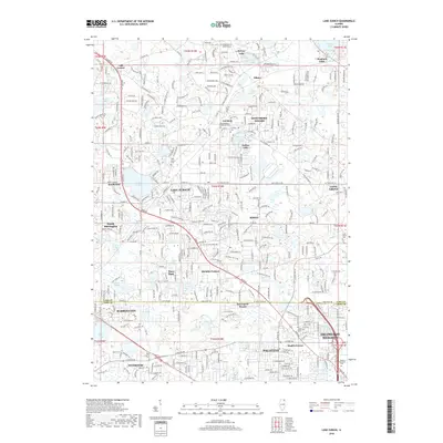
2018 Map of Lake Zurich
USGS Topo · Published 2018About this map
Lake Zurich and surrounding communities like Hawthorn Woods and Kildeer characterize this landscape in Lake and Cook counties. The map captures a high level of residential development around numerous water bodies, including Sylvan Lake, Diamond Lake, and Lake Naomi. Local history is anchored by several cemeteries that mark the era of early settlement, such as Fairfield Cem, Long Grove Cem, and Saint Matthew Lutheran Cem. The southern portion of the sheet shows the edge of larger municipalities like Palatine, Arlington Heights, and Barrington.
Find a feature on this map
145 named features on this map. Tap any name to fly to it.
Don’t see what you’re looking for? This feature index may not catch every label — zoom into the map to look around manually.
Map Details
Editions of this 2018 Lake Zurich Map
This is the sole edition of this map. No revisions or reprints were ever made.
Other maps of this area

1900 · Highwood
USGS Topo · 1:62,500

1906 · Waukegan
USGS Topo · 1:62,500

1908 · Waukegan
USGS Topo · 1:62,500

1920 · Grays Lake
USGS Topo · 1:62,500

1923 · Grays Lake
USGS Topo · 1:62,500

1923 · Barrington
USGS Topo · 1:62,500

1927 · Arlington Heights
USGS Topo · 1:24,000

1928 · Wheeling
USGS Topo · 1:24,000

1935 · Barrington
USGS Topo · 1:62,500
1953 · Arlington Heights
USGS Topo · 1:24,000