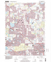
1998 Map of Lake Zurich
USGS Topo · Published 2001About this map
Lake Zurich sits at the heart of this late-20th-century landscape, surrounded by a complex network of established residential developments and preserved green spaces. The map reveals the post-war suburban transformation of Lake and Cook counties, where former agricultural tracts have been replaced by the winding streets of Hawthorn Woods, Kildeer, and Inverness. This era is defined by its educational and social infrastructure, visible in landmarks like the Mt St Joseph Childrens Home and numerous local schools such as Whitney Sch and Paine Sch.
Find a feature on this map
68 named features on this map. Tap any name to fly to it.
Don’t see what you’re looking for? This feature index may not catch every label — zoom into the map to look around manually.
Map Details
Editions of this 1998 Lake Zurich Map
This is the sole edition of this map. No revisions or reprints were ever made.
Other maps of this area

1900 · Highwood
USGS Topo · 1:62,500

1906 · Waukegan
USGS Topo · 1:62,500

1908 · Waukegan
USGS Topo · 1:62,500

1920 · Grays Lake
USGS Topo · 1:62,500

1923 · Grays Lake
USGS Topo · 1:62,500

1923 · Barrington
USGS Topo · 1:62,500

1927 · Arlington Heights
USGS Topo · 1:24,000

1928 · Wheeling
USGS Topo · 1:24,000

1935 · Barrington
USGS Topo · 1:62,500
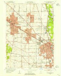
1953 · Arlington Heights
USGS Topo · 1:24,000