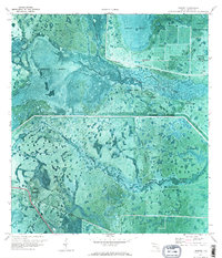
1970 Map of Lakeport
USGS Topo · Published 1976About this map
Fisheating Creek winds through a vast complex of wetlands and historical sites along the western edge of Lake Okeechobee. This landscape is defined by the massive Herbert Hoover Dyke and the Rim Canal, engineering works that separate the interior marshlands from the lake. Historical interest centers on Fort Centre and numerous Indian Mounds situated near Sheridan Bend, evidence of long-standing human occupation in these flood-prone reaches.
Find a feature on this map
20 named features on this map. Tap any name to fly to it.
Don’t see what you’re looking for? This feature index may not catch every label — zoom into the map to look around manually.
Map Details
Editions of this 1970 Lakeport Map
3 editions found
Other maps of this area

1953 · Brighton SW
USGS Topo · 1:24,000

1953 · Brighton SE
USGS Topo · 1:24,000

1956 · West Palm Beach
USGS Topo · 1:250,000

1956 · Fort Pierce
USGS Topo · 1:250,000

1957 · West Palm Beach
USGS Topo · 1:250,000

1957 · Venus
USGS Topo · 1:24,000

1958 · Fort Pierce
USGS Topo · 1:250,000

1958 · West Palm Beach
USGS Topo · 1:250,000

1958 · Goodno
USGS Topo · 1:24,000
1958 · Palmdale
USGS Topo · 1:24,000