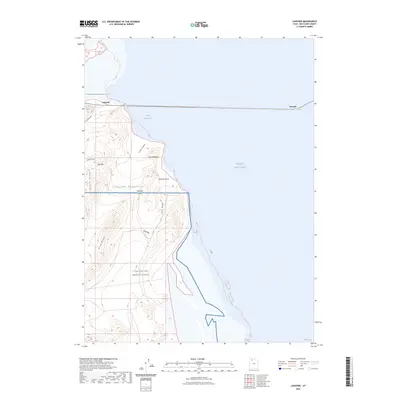
2023 Map of Lakeside
USGS Topo · Published 2023About this map
The Lakeside Mountains dominate this western shore of the Great Salt Lake, where the desert terrain meets the brine of Gilbert Bay. This area is defined by its isolation and restricted access, with much of the southern portion of the map occupied by the Utah Test and Training Range. The settlement at Lakeside serves as a critical point along the railroad causeway that cuts across the water toward Tresend, illustrating the modern engineering required to traverse this saline environment.
Find a feature on this map
18 named features on this map. Tap any name to fly to it.
Don’t see what you’re looking for? This feature index may not catch every label — zoom into the map to look around manually.
Map Details
Editions of this 2023 Lakeside Map
This is the sole edition of this map. No revisions or reprints were ever made.
Other maps of this area

1954 · Brigham City
USGS Topo · 1:250,000

1958 · Brigham City
USGS Topo · 1:250,000

1962 · Brigham City
USGS Topo · 1:250,000

1968 · Carrington Island SW
USGS Topo · 1:24,000

1968 · Deardens Knoll
USGS Topo · 1:24,000

1969 · Rozel Point SW
USGS Topo · 1:24,000

1969 · Gunnison Island SW
USGS Topo · 1:24,000

1969 · Carrington Island NW
USGS Topo · 1:24,000

1969 · Strongs Knob
USGS Topo · 1:24,000

1969 · Gunnison Island
USGS Topo · 1:24,000