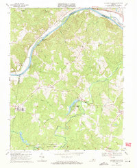
1969 Map of Lakeside Village
USGS Topo · Published 1971About this map
The James River forms a prominent boundary in the north, carving past Boatwrights Island and Elk Island while the Chesapeake and Ohio railroad follows its southern bank. This central Virginia landscape is defined by the convergence of the Willis River and several creek systems, including Big Cattail Creek and Snowquarter Creek. To the south, the timbered expanses of the Cumberland State Forest dominate the terrain, surrounding small water bodies like Sports Lake and Trice Lake.
Find a feature on this map
39 named features on this map. Tap any name to fly to it.
Don’t see what you’re looking for? This feature index may not catch every label — zoom into the map to look around manually.
Map Details
Editions of this 1969 Lakeside Village Map
2 editions found
Other maps of this area

1891 · Palmyra
USGS Topo · 1:125,000

1895 · Palmyra
USGS Topo · 1:125,000

1897 · Palmyra
USGS Topo · 1:125,000

1943 · Scottsville
USGS Topo · 1:62,500

1946 · Scottsville
USGS Topo · 1:62,500

1947 · Roanoke
USGS Topo · 1:250,000

1950 · Dillwyn
USGS Topo · 1:62,500

1958 · Dillwyn
USGS Topo · 1:62,500

1959 · Roanoke
USGS Topo · 1:250,000

1960 · Columbia
USGS Topo · 1:62,500