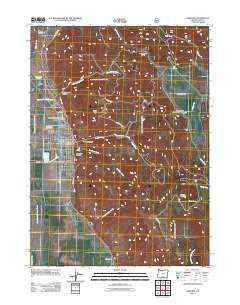
2011 Map of Lakeview
USGS Topo · Published 2011About this map
The town of Lakeview serves as the focal point of this 2011 survey, situated at the edge of the high desert and timbered slopes of southern Oregon. The community layout is detailed with its street grid, featuring the Lakeview Post Office and the Lake County Fairgrounds as central landmarks. To the north, the landscape rises into Warner Canyon, home to the Warner Canyon Ski Area and the geothermal waters of Hunters Hot Springs. Genealogy researchers will find the Sunset Cemetery and the Independent Order of Odd Fellows Cemetery clearly marked on the northern outskirts. The eastern terrain is defined by dramatic local relief, including Black Cap and the broad Camas Prairie. Water sources like Hammersley Creek and Deadman Creek drain from these heights toward the valley floor near Vernon Ranch.
Find a feature on this map
46 named features on this map. Tap any name to fly to it.
Don’t see what you’re looking for? This feature index may not catch every label — zoom into the map to look around manually.
Map Details
Editions of this 2011 Lakeview Map
This is the sole edition of this map. No revisions or reprints were ever made.
Other maps of this area

1955 · Klamath Falls
USGS Topo · 1:250,000

1958 · Klamath Falls
USGS Topo · 1:250,000

1964 · Lakeview NE
USGS Topo · 1:24,000

1964 · Crooked Creek Valley
USGS Topo · 1:24,000

1964 · Lakeview SW
USGS Topo · 1:24,000

1964 · Lakeview NW
USGS Topo · 1:24,000
1964 · Crane Creek
USGS Topo · 1:24,000

1964 · Big Baldy
USGS Topo · 1:24,000

1968 · Crook Peak
USGS Topo · 1:24,000
1968 · Horse Prairie
USGS Topo · 1:24,000