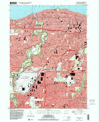
1994 Map of Lakewood
USGS Topo · Published 2000About this map
The Rocky River Metropolitan Reservation snakes through this densely developed corridor of suburban Cuyahoga County, providing a prominent green belt between the growing communities of Rocky River and Fairview Park. This mid-1990s survey illustrates a landscape of established residential grids and significant institutional footprints, including the sprawling Cleveland-Hopkins International Airport and the expansive Holy Cross Cemetery. Local neighborhoods are defined by their schools and parishes, such as St Lukes Sch and St James Sch in Lakewood, reflecting the area's mid-century social structure.
Find a feature on this map
134 named features on this map. Tap any name to fly to it.
Don’t see what you’re looking for? This feature index may not catch every label — zoom into the map to look around manually.
Map Details
Editions of this 1994 Lakewood Map
This is the sole edition of this map. No revisions or reprints were ever made.
Other maps of this area

1901 · Euclid
USGS Topo · 1:62,500

1902 · Berea
USGS Topo · 1:62,500

1903 · Cleveland
USGS Topo · 1:62,500

1903 · Euclid
USGS Topo · 1:62,500

1904 · Berea
USGS Topo · 1:62,500

1950 · Cleveland
USGS Topo · 1:250,000

1953 · West View
USGS Topo · 1:24,000

1953 · Broadview Heights
USGS Topo · 1:24,000

1953 · Berea
USGS Topo · 1:24,000
1953 · Cleveland South
USGS Topo · 1:24,000