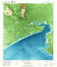
1979 Map of Lamar
USGS Topo · Published 1979About this map
Copano Bay dominates this coastal landscape on the Lamar Peninsula during the late 1970s. The map illustrates a region defined by its intersection of natural shoreline and industrial development, where numerous flowing wells like Madero Well and Schultz Well are scattered across the brushy terrain north of the bay. The industrial footprint extends directly into the water via the Copano Bay Oil and Gas Field, marked by several offshore oil wells.
Find a feature on this map
33 named features on this map. Tap any name to fly to it.
Don’t see what you’re looking for? This feature index may not catch every label — zoom into the map to look around manually.
Map Details
Editions of this 1979 Lamar Map
This is the sole edition of this map. No revisions or reprints were ever made.
Other maps of this area

1952 · St. Charles Bay SW
USGS Topo · 1:24,000

1952 · St. Charles Bay
USGS Topo · 1:24,000

1952 · Tivoli SW
USGS Topo · 1:24,000

1953 · Beeville
USGS Topo · 1:250,000

1954 · Rockport
USGS Topo · 1:62,500

1954 · Vidaurri
USGS Topo · 1:62,500

1956 · Beeville
USGS Topo · 1:250,000

1960 · Beeville
USGS Topo · 1:250,000
1978 · Twin Mott Lake
USGS Topo · 1:24,000
1979 · Mission Bay
USGS Topo · 1:24,000