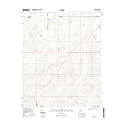
2015 Map of Lamar
USGS Topo · Published 2015About this map
Lamar and Michigan City anchor this northern Mississippi landscape where the state border meets Tennessee. The terrain is defined by a dense network of family-named landmarks and rural burial grounds, including the Old Lamar Cem and the Hickory Hill Cem, reflecting generations of settlement in Benton and Marshall Counties. Waterways like the Wolf River and Grays Creek carve through the countryside, influencing the early road patterns such as Allen Corner Rd and Rice Chapel Rd. The presence of numerous small cemeteries, such as Worship Cem and Rynehart Cem, suggests a long-standing community structure where local life centered around these small, scattered hubs. This map preserves the 2015 layout of these rural corridors before further modernization, offering a clear view of the historic land divisions and the original township lines that still govern the area.
Find a feature on this map
65 named features on this map. Tap any name to fly to it.
Don’t see what you’re looking for? This feature index may not catch every label — zoom into the map to look around manually.
Map Details
Editions of this 2015 Lamar Map
This is the sole edition of this map. No revisions or reprints were ever made.
Other maps of this area

1949 · Moscow
USGS Topo · 1:62,500

1950 · Ashland
USGS Topo · 1:62,500

1950 · Grand Junction
USGS Topo · 1:24,000

1951 · Grand Junction
USGS Topo · 1:24,000

1953 · Holly Springs
USGS Topo · 1:62,500

1956 · Blytheville
USGS Topo · 1:250,000

1956 · Tupelo
USGS Topo · 1:250,000

1958 · Tupelo
USGS Topo · 1:250,000

1959 · Blytheville
USGS Topo · 1:250,000

1964 · Holly Springs SE
USGS Topo · 1:24,000