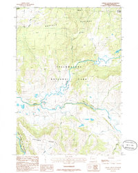
1986 Map of Lamar Canyon
USGS Topo · Published 1986About this map
Yellowstone National Park dominates this mid-1980s landscape, centered on the confluence where the Slough Creek valley meets the Lamar River. The terrain is defined by dramatic elevation changes, rising from the riverbed through Lamar Canyon toward the high reaches of the Buffalo Plateau in the north and Specimen Ridge to the south. This survey documents the backcountry infrastructure of the era, including a Campground, a Corral, and a Gravel Pit, alongside an extensive network of Pack Trails that provided the primary access through these remote drainages. Small tributaries such as Quartz Creek, Crystal Creek, and Amethyst Creek carve through the ridges, feeding the larger river system that eventually reaches the Grand Canyon of the Yellowstone River in the southwestern corner of the sheet.
Find a feature on this map
20 named features on this map. Tap any name to fly to it.
Don’t see what you’re looking for? This feature index may not catch every label — zoom into the map to look around manually.
Map Details
Editions of this 1986 Lamar Canyon Map
2 editions found
Other maps of this area

1886 · Canyon
USGS Topo · 1:125,000

1891 · Livingston
USGS Topo · 1:250,000

1893 · Livingston
USGS Topo · 1:250,000

1895 · Canyon
USGS Topo · 1:125,000

1896 · Canyon
USGS Topo · 1:125,000

1901 · Canyon
USGS Topo · 1:125,000

1907 · Canyon
USGS Topo · 1:125,000

1911 · Canyon
USGS Topo · 1:125,000

1940 · Mt Wallace
USGS Topo · 1:62,500

1942 · Cutoff Mtn
USGS Topo · 1:62,500