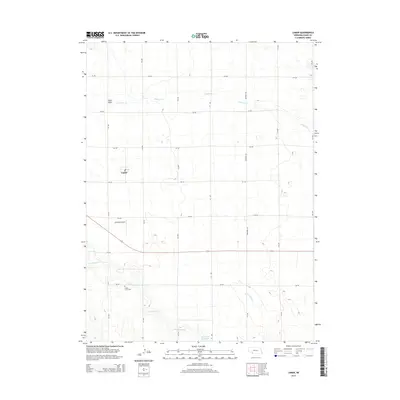
2014 Map of Lamar
USGS Topo · Published 2014About this map
Lamar stands as a quiet focal point in this 2014 survey of western Chase County, Nebraska. The landscape is defined by the steady geometric grid of section roads like 314 Ave and 740 RD, which traverse the undulating terrain of the High Plains. Drainage patterns are dictated by the intermittent flows of Wildhorse Cr to the north and Frenchman Cr to the south, the latter feeding into the Arterburn Reservoir. For those researching family history, the Green Lawn Cem sits south of town along the creek banks. The presence of Larrabee Airport and numerous rural homesteads connected by numbered routes illustrates the modern agricultural character of the region. Distinctive natural features such as Sand Draw and Walnut Slough break the prairie's uniformity, revealing the subtle hydrology of this Nebraska panhandle borderland.
Find a feature on this map
23 named features on this map. Tap any name to fly to it.
Don’t see what you’re looking for? This feature index may not catch every label — zoom into the map to look around manually.
Map Details
Editions of this 2014 Lamar Map
This is the sole edition of this map. No revisions or reprints were ever made.
Other maps of this area

1954 · Sterling
USGS Topo · 1:250,000

1954 · McCook
USGS Topo · 1:250,000

1957 · McCook
USGS Topo · 1:250,000

1958 · McCook
USGS Topo · 1:250,000

1958 · Sterling
USGS Topo · 1:250,000

1961 · Lamar NE
USGS Topo · 1:24,000

1961 · Lamar
USGS Topo · 1:24,000

1961 · Lamar NW
USGS Topo · 1:24,000

1962 · Amherst NE
USGS Topo · 1:24,000

1971 · Amherst SE
USGS Topo · 1:24,000