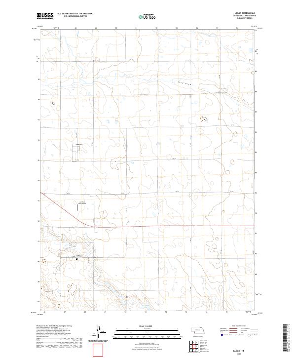
2021 Map of Lamar
USGS Topo · Published 2021About this map
Lamar anchors this southwestern Chase County landscape, situated within a vast grid of section lines and rural roads that define the agricultural character of the Nebraska high plains. The terrain is marked by the intermittent course of Sand Draw in the north and the quiet presence of Arterburn Lake to the south. This 2021 survey reflects the enduring spatial organization of the region, where the township and range system (including t7n r41w and t8n r41w) dictates the placement of homesteads and infrastructure. Cultural landmarks such as Green Lawn Cem and the Larrabee Farm Airport provide specific points of interest for genealogists and local historians, illustrating the intersection of pioneer legacy and modern aviation in this remote corner of the state.
Find a feature on this map
23 named features on this map. Tap any name to fly to it.
Don’t see what you’re looking for? This feature index may not catch every label — zoom into the map to look around manually.
Map Details
Editions of this 2021 Lamar Map
This is the sole edition of this map. No revisions or reprints were ever made.
Other maps of this area

1954 · Sterling
USGS Topo · 1:250,000

1954 · McCook
USGS Topo · 1:250,000

1957 · McCook
USGS Topo · 1:250,000

1958 · McCook
USGS Topo · 1:250,000

1958 · Sterling
USGS Topo · 1:250,000

1961 · Lamar NE
USGS Topo · 1:24,000

1961 · Lamar
USGS Topo · 1:24,000

1961 · Lamar NW
USGS Topo · 1:24,000

1962 · Amherst NE
USGS Topo · 1:24,000

1971 · Amherst SE
USGS Topo · 1:24,000