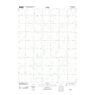
2012 Map of Lamar
USGS Topo · Published 2012About this map
Lamar anchors this rural Kansas landscape, situated near the confluence where Middle Pipe Cr and E Pipe Cr join to form Pipe Cr. This 2012 USGS survey reflects the persistent agricultural character of Ottawa County, defined by a rigid section-line road grid that includes Windmill Rd and Volunteer Rd. For those researching local heritage, the map identifies two significant burial sites: Oakland Union Cem in the northern reaches and Fairview Cem further south. The drainage patterns of the Pipe Creek system dictate the subtle topography, weaving through a landscape of large-scale farming plots and established township boundaries.
Find a feature on this map
23 named features on this map. Tap any name to fly to it.
Don’t see what you’re looking for? This feature index may not catch every label — zoom into the map to look around manually.
Map Details
Editions of this 2012 Lamar Map
This is the sole edition of this map. No revisions or reprints were ever made.
Other maps of this area

1891 · Clay Center
USGS Topo · 1:125,000

1892 · Minneapolis
USGS Topo · 1:125,000

1955 · Manhattan
USGS Topo · 1:250,000

1956 · Manhattan
USGS Topo · 1:250,000

1957 · Manhattan
USGS Topo · 1:250,000

1964 · Lamar
USGS Topo · 1:24,000

1964 · Miltonvale
USGS Topo · 1:24,000

1965 · Aurora
USGS Topo · 1:24,000
1965 · Manchester NW
USGS Topo · 1:24,000

1965 · Minneapolis North
USGS Topo · 1:24,000