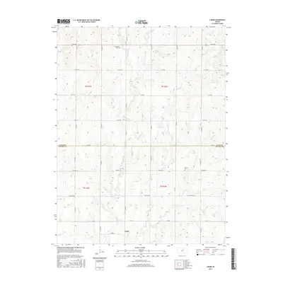
2015 Map of Lamar
USGS Topo · Published 2015About this map
Lamar anchors this section of the Central Plains, situated in a landscape defined by the branching tributaries of the Solomon River watershed. The geography is characterized by the steady winding of Middle Pipe Cr, E Pipe Cr, and Pipe Cr as they cut through the section lines of the Public Land Survey System. For genealogists and local historians, the presence of the Oakland Union Cem in the north and Fairview Cem further south provides concrete points of reference for the families who settled this border region between Cloud and Ottawa counties. A rigid network of rural routes, including Co RD 388 and Windmill Rd, follows the grid-based settlement pattern typical of the Kansas prairie, connecting isolated homesteads to the small community of Lamar.
Find a feature on this map
22 named features on this map. Tap any name to fly to it.
Don’t see what you’re looking for? This feature index may not catch every label — zoom into the map to look around manually.
Map Details
Editions of this 2015 Lamar Map
This is the sole edition of this map. No revisions or reprints were ever made.
Other maps of this area

1891 · Clay Center
USGS Topo · 1:125,000

1892 · Minneapolis
USGS Topo · 1:125,000

1955 · Manhattan
USGS Topo · 1:250,000

1956 · Manhattan
USGS Topo · 1:250,000

1957 · Manhattan
USGS Topo · 1:250,000

1964 · Lamar
USGS Topo · 1:24,000

1964 · Miltonvale
USGS Topo · 1:24,000

1965 · Aurora
USGS Topo · 1:24,000
1965 · Manchester NW
USGS Topo · 1:24,000

1965 · Minneapolis North
USGS Topo · 1:24,000