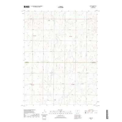
2018 Map of Lamar
USGS Topo · Published 2018About this map
Lamar sits at the southern edge of this north-central Kansas landscape, where the prairie is carved by an intricate network of waterways. The drainage pattern is dominated by the winding paths of Middle Pipe Cr and Pipe Cr, which converge as they flow southward through the agricultural heartland. This 2018 survey reveals a rural infrastructure defined by a grid of section-line roads, including Windmill Rd and Volunteer Rd, reflecting the enduring Public Land Survey System. Genealogists will find historical value in the presence of Oakland Union Cem in the north and Fairview Cem near the center of the sheet. The boundary line between Cloud County and Ottawa County bisects the map, marking a transition between these two central plains jurisdictions while maintaining the consistent farm-to-market road network that connects the scattered homesteads of the region.
Find a feature on this map
21 named features on this map. Tap any name to fly to it.
Don’t see what you’re looking for? This feature index may not catch every label — zoom into the map to look around manually.
Map Details
Editions of this 2018 Lamar Map
This is the sole edition of this map. No revisions or reprints were ever made.
Other maps of this area

1891 · Clay Center
USGS Topo · 1:125,000

1892 · Minneapolis
USGS Topo · 1:125,000

1955 · Manhattan
USGS Topo · 1:250,000

1956 · Manhattan
USGS Topo · 1:250,000

1957 · Manhattan
USGS Topo · 1:250,000

1964 · Lamar
USGS Topo · 1:24,000

1964 · Miltonvale
USGS Topo · 1:24,000

1965 · Aurora
USGS Topo · 1:24,000
1965 · Manchester NW
USGS Topo · 1:24,000

1965 · Minneapolis North
USGS Topo · 1:24,000