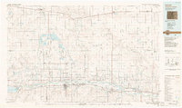
1988 Map of Lamar
USGS Topo · Published 1988About this map
The Arkansas River valley defines this late-twentieth-century landscape, where a sophisticated network of irrigation canals like the Fort Lyon Canal and Amity Canal transformed the arid High Plains. This era of agricultural and industrial water management is visible through the massive John Martin Reservoir and the Neenoshe Reservoir system to the north. Traces of historical movement cross the region, from the ancient route of the Santa Fe Trail to the dominant lines of the Atchison Topeka and Santa Fe Railroad.
Find a feature on this map
90 named features on this map. Tap any name to fly to it.
Don’t see what you’re looking for? This feature index may not catch every label — zoom into the map to look around manually.
Map Details
Editions of this 1988 Lamar Map
This is the sole edition of this map. No revisions or reprints were ever made.
Other maps of this area

1890 · Granada
USGS Topo · 1:125,000

1891 · Arroyo
USGS Topo · 1:125,000

1891 · Albany
USGS Topo · 1:125,000

1891 · Kit Carson
USGS Topo · 1:125,000

1891 · Higbee
USGS Topo · 1:125,000

1891 · Las Animas
USGS Topo · 1:125,000

1892 · Lamar
USGS Topo · 1:125,000

1892 · Cheyenne Wells
USGS Topo · 1:125,000

1892 · Granada
USGS Topo · 1:125,000

1892 · Two Butte
USGS Topo · 1:125,000