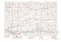
1954 Map of Lamar
USGS Topo · Published 1978About this map
The Arkansas River valley serves as the primary corridor for settlement and industry across this high plains region, flanked by the sprawling waters of the John Martin Reservoir and Lake Meredith. The landscape is defined by the intersection of major transportation routes, where the Atchison Topeka and Santa Fe railroad follows the river through agricultural hubs like La Junta and Rocky Ford, while the Missouri Pacific line traverses the northern plains near Haswell and Eads.
Find a feature on this map
63 named features on this map. Tap any name to fly to it.
Don’t see what you’re looking for? This feature index may not catch every label — zoom into the map to look around manually.
Map Details
Editions of this 1954 Lamar Map
3 editions found

Other maps of this area

1889 · Sanborn
USGS Topo · 1:125,000

1890 · Granada
USGS Topo · 1:125,000

1891 · Sanborn
USGS Topo · 1:125,000

1891 · Catlin
USGS Topo · 1:125,000

1891 · Arroyo
USGS Topo · 1:125,000

1891 · Albany
USGS Topo · 1:125,000

1891 · Kit Carson
USGS Topo · 1:125,000

1891 · Higbee
USGS Topo · 1:125,000

1891 · Las Animas
USGS Topo · 1:125,000

1891 · Timpas
USGS Topo · 1:125,000