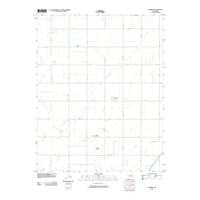
2009 Map of Lambert
USGS Topo · Published 2009About this map
Lambert sits at the center of this rural Oklahoma landscape, defined by a strict section-line road grid and the meandering drainage of Cottonwood Creek. The settlement pattern reflects the agricultural character of Alfalfa County, where homesteads and infrastructure are organized around the intersection of routes like n2570 RD and e0230 RD. To the north, Auburn Cemetery serves as a significant genealogical marker for local families, while the landscape to the south is shaped by water management efforts. The presence of Lambert Creek Site 1 Dam and Lambert Creek Site 2 Dam along the headwaters of Lambert Creek indicates the importance of soil and water conservation in this prairie environment. The southern edge of the quadrangle is further delineated by West Clay Creek, which cuts across the regular geometry of the township and range survey lines.
Find a feature on this map
22 named features on this map. Tap any name to fly to it.
Don’t see what you’re looking for? This feature index may not catch every label — zoom into the map to look around manually.
Map Details
Editions of this 2009 Lambert Map
This is the sole edition of this map. No revisions or reprints were ever made.
Other maps of this area

1955 · Woodward
USGS Topo · 1:250,000

1958 · Woodward
USGS Topo · 1:250,000

1968 · Carmen
USGS Topo · 1:24,000

1969 · Dacoma
USGS Topo · 1:24,000

1969 · Lambert
USGS Topo · 1:24,000

1969 · Alva SE
USGS Topo · 1:24,000

1969 · Helena
USGS Topo · 1:24,000

1969 · Cherokee North
USGS Topo · 1:24,000

1969 · Ingersoll
USGS Topo · 1:24,000
1969 · Dacoma SE
USGS Topo · 1:24,000