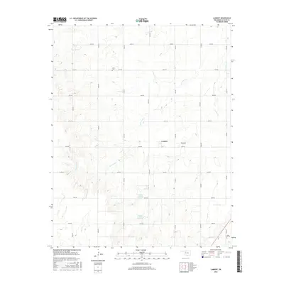
2016 Map of Lambert
USGS Topo · Published 2016About this map
Lambert and Yewed sit at the center of this rural Alfalfa County landscape, where the grid of sections is deeply etched by the winding drainages of Cottonwood Creek and Lambert Creek. The map documents a classic Oklahoma prairie settlement pattern, defined by isolated farmsteads and small rural communities connected by a rigid network of section-line roads like Grady Road and Craig Road. Two local burial sites, Auburn Cemetery to the north and Maple Grove Cemetery in the southeast, provide primary points of interest for genealogists tracing family roots in this agricultural region. Water management is a visible priority on the land, evidenced by the Lambert Creek Site 1 Reservoir and Lambert Creek Site 2 Reservoir, which serve the surrounding fields during a period of modern conservation and irrigation.
Find a feature on this map
27 named features on this map. Tap any name to fly to it.
Don’t see what you’re looking for? This feature index may not catch every label — zoom into the map to look around manually.
Map Details
Editions of this 2016 Lambert Map
This is the sole edition of this map. No revisions or reprints were ever made.
Other maps of this area

1955 · Woodward
USGS Topo · 1:250,000

1958 · Woodward
USGS Topo · 1:250,000

1968 · Carmen
USGS Topo · 1:24,000

1969 · Dacoma
USGS Topo · 1:24,000

1969 · Lambert
USGS Topo · 1:24,000

1969 · Alva SE
USGS Topo · 1:24,000

1969 · Helena
USGS Topo · 1:24,000

1969 · Cherokee North
USGS Topo · 1:24,000

1969 · Ingersoll
USGS Topo · 1:24,000
1969 · Dacoma SE
USGS Topo · 1:24,000