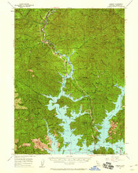
1957 Map of Lamoine
USGS Topo · Published 1959About this map
The waters of Shasta Lake dominate the landscape of this 1957 survey, where the rising reservoir has transformed the canyons of the Sacramento River, Pit River, and McCloud River into a complex network of bays and inlets. Along the northern reaches, the Southern Pacific railroad and U S 99 trace the narrow corridor through Lamoine and Delta, following the old canyon floor toward Pollard Flat.
Find a feature on this map
109 named features on this map. Tap any name to fly to it.
Don’t see what you’re looking for? This feature index may not catch every label — zoom into the map to look around manually.
Map Details
Editions of this 1957 Lamoine Map
2 editions found
Other maps of this area

1886 · Shasta
USGS Topo · 1:250,000

1890 · Red Bluff
USGS Topo · 1:250,000

1894 · Red Bluff
USGS Topo · 1:250,000

1894 · Shasta
USGS Topo · 1:250,000

1901 · Redding
USGS Topo · 1:125,000

1913 · Weaverville
USGS Topo · 1:125,000

1923 · Sawyers Bar
USGS Topo · 1:125,000

1931 · Etna
USGS Topo · 1:96,000

1934 · Etna
USGS Topo · 1:125,000

1935 · Dunsmuir
USGS Topo · 1:125,000