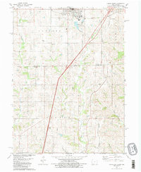
1981 Map of Lamoni South
USGS Topo · Published 1981About this map
Lamoni serves as the focal point of this 1981 survey, anchored by the campus of Graceland College and the surrounding residential streets of northern Decatur County. The landscape transitions from the developed edge of town into the rolling drainage basins of Shain Creek and the East Fork Big Creek. This rural territory, spanning the Iowa and Missouri border, is marked by a network of established family and community landmarks, including Rose Hill Cem and Sweet Home Cem. The presence of the Burlington Northern railroad corridor and local nodes like Giles Junction and Andover illustrates a settlement pattern tied to rail transport and small-scale agriculture. Scattered country churches such as Otterbein Ch and Olive Ch further define the social geography of Fayette and Colfax townships at the start of the 1980s.
Find a feature on this map
27 named features on this map. Tap any name to fly to it.
Don’t see what you’re looking for? This feature index may not catch every label — zoom into the map to look around manually.
Map Details
Editions of this 1981 Lamoni South Map
2 editions found
Other maps of this area

1945 · Mount Ayr
USGS Topo · 1:62,500

1945 · Lamoni
USGS Topo · 1:62,500

1947 · Lamoni
USGS Topo · 1:62,500

1947 · Blythedale
USGS Topo · 1:62,500

1947 · Mount Ayr
USGS Topo · 1:62,500

1948 · Bethany
USGS Topo · 1:62,500

1954 · Centerville
USGS Topo · 1:250,000

1955 · Nebraska City
USGS Topo · 1:250,000

1957 · Nebraska City
USGS Topo · 1:250,000

1957 · Centerville
USGS Topo · 1:250,000