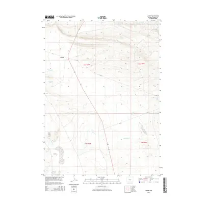
2015 Map of Lamont
USGS Topo · Published 2015About this map
Lamont sits at the junction of WY-73 and the combined route of U.S. 287 and U.S. 789, serving as a central point in this Carbon County landscape. The area is defined by a complex drainage system where Sand Springs Creek and Iron Springs Creek carve through the high plains. Water features such as Marsh Reservoir, Mahoney Lake, and Lost Soldier Lake indicate a terrain where seasonal runoff and localized springs are vital to the local ecology. The map reveals the infrastructure of the region through roads like CC Road 100 and CR-104, which provide access to more remote landmarks like Big Sand Spring and the topographical depression of Rocky Draw. This survey captures the sparse but organized settlement pattern of Wyoming's high desert country during the early 21st century.
Find a feature on this map
19 named features on this map. Tap any name to fly to it.
Don’t see what you’re looking for? This feature index may not catch every label — zoom into the map to look around manually.
Map Details
Editions of this 2015 Lamont Map
This is the sole edition of this map. No revisions or reprints were ever made.
Other maps of this area

1955 · Casper
USGS Topo · 1:250,000

1958 · Casper
USGS Topo · 1:250,000

1960 · Separation Rim
USGS Topo · 1:24,000

1960 · Bull Springs
USGS Topo · 1:24,000

1960 · Boggy Meadows
USGS Topo · 1:24,000

1961 · Lamont NE
USGS Topo · 1:24,000

1961 · Lamont
USGS Topo · 1:24,000

1961 · Bairoil
USGS Topo · 1:24,000

1962 · Casper
USGS Topo · 1:250,000

1962 · Whiskey Peak
USGS Topo · 1:24,000