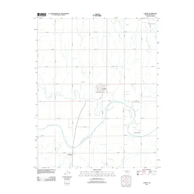
2013 Map of Lamont
USGS Topo · Published 2013About this map
The Salt Fork Arkansas River carves a winding path through this corner of Grant County, creating prominent topographical features such as Whitworth Bend. The town of Lamont serves as the central hub, organized on a grid with streets including State St, W Harrison Ave, and S Main St. Local history and genealogy are centered around the Lamont Cem to the north and the small settlement of Salt Fork near the southern edge of the sheet.
Find a feature on this map
33 named features on this map. Tap any name to fly to it.
Don’t see what you’re looking for? This feature index may not catch every label — zoom into the map to look around manually.
Map Details
Editions of this 2013 Lamont Map
This is the sole edition of this map. No revisions or reprints were ever made.
Other maps of this area

1955 · Enid
USGS Topo · 1:250,000

1958 · Enid
USGS Topo · 1:250,000

1968 · Lamont SE
USGS Topo · 1:24,000

1968 · Lamont NW
USGS Topo · 1:24,000

1968 · Deer Creek
USGS Topo · 1:24,000

1968 · Billings
USGS Topo · 1:24,000

1968 · Hunter
USGS Topo · 1:24,000

1968 · Eddy
USGS Topo · 1:24,000

1968 · Nardin
USGS Topo · 1:24,000

1968 · Medford
USGS Topo · 1:24,000