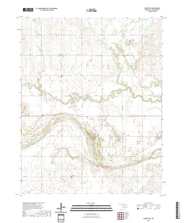
2022 Map of Lamont NW
USGS Topo · Published 2022About this map
The Salt Fork Arkansas River carves a wide, braided path across the southern half of this landscape in Grant County, Oklahoma. This 2022 survey documents the section lines and rural infrastructure typical of the state's northern plains. The terrain is defined by a dense network of intermittent drainages, including Bullwacker Cr, Pond Cr, and Cottonwood Cr, which feed into the larger river valley. For genealogists and local historians, the map serves as a precise guide to long-standing community landmarks such as Liberty Cem, Fairview Cem, and Goldsmith Cem. These burial grounds, often the most enduring markers of early prairie settlement, are situated along a grid of county roads like Grady Rd and Garvin Rd that delineate the agricultural tracts between the shifting riverbanks and northern creeks.
Find a feature on this map
33 named features on this map. Tap any name to fly to it.
Don’t see what you’re looking for? This feature index may not catch every label — zoom into the map to look around manually.
Map Details
Editions of this 2022 Lamont NW Map
This is the sole edition of this map. No revisions or reprints were ever made.
Other maps of this area

1955 · Enid
USGS Topo · 1:250,000

1958 · Enid
USGS Topo · 1:250,000

1968 · Lamont SE
USGS Topo · 1:24,000

1968 · Lamont NW
USGS Topo · 1:24,000

1968 · Deer Creek
USGS Topo · 1:24,000

1968 · Hunter
USGS Topo · 1:24,000

1968 · Wakita SE
USGS Topo · 1:24,000

1968 · Kremlin
USGS Topo · 1:24,000

1968 · Medford
USGS Topo · 1:24,000

1968 · Lamont
USGS Topo · 1:24,000