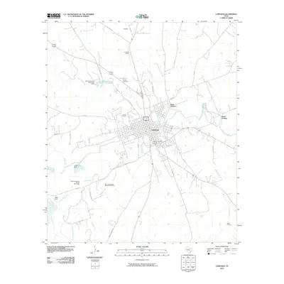
2010 Map of Lampasas
USGS Topo · Published 2010About this map
Lampasas serves as the focal point of this Central Texas landscape, situated at the confluence of several key waterways including Sulphur Creek and Burleson Creek. The town's layout is well-established by this era, branching out toward the Lampasas Airport and the smaller community of Radio Junction to the northeast. Local history and genealogy are preserved in sites like the large Oak Hill Cemetery on the western edge of town and the more distant Bailey Cemetery to the southeast. The terrain is marked by distinctive elevations such as Indian Bluff and Pillar Bluff, while the water management of the region is evident through several flood control structures, including the Soil Conservation Service Site 8 Dam and the Jones Lake Dam. This record captures a moment of modern growth while maintaining traditional landmarks like Gooch Spring and the crossing at Sparks Crossing.
Find a feature on this map
55 named features on this map. Tap any name to fly to it.
Don’t see what you’re looking for? This feature index may not catch every label — zoom into the map to look around manually.
Map Details
Editions of this 2010 Lampasas Map
This is the sole edition of this map. No revisions or reprints were ever made.
Other maps of this area

1887 · Lampasas
USGS Topo · 1:125,000

1887 · Burnet
USGS Topo · 1:125,000

1893 · Burnet
USGS Topo · 1:125,000

1894 · Lampasas
USGS Topo · 1:125,000

1903 · Burnet
USGS Topo · 1:125,000

1909 · Burnet
USGS Topo · 1:125,000

1932 · Tow
USGS Topo · 1:62,500

1954 · Brownwood
USGS Topo · 1:250,000

1954 · Lampasas
USGS Topo · 1:62,500

1954 · Lampasas
USGS Topo · 1:24,000