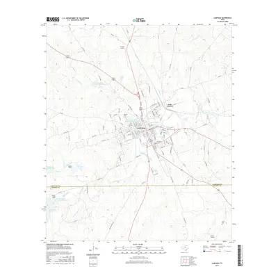
2016 Map of Lampasas
USGS Topo · Published 2016About this map
Lampasas serves as the central hub of this 2016 survey, situated at the confluence of several significant water sources including Gooch Spring, Hancock Springs, and Gold Spring. The town's grid is well-defined, stretching toward Radio Junction and the BNSF Railway corridor. The landscape is characterized by a series of Soil Conservation Service reservoirs, such as Soil Conservation Service Site 9 Reservoir and Soil Conservation Service Site 5 Reservoir, which manage the drainage of Burleson Creek and Cemetery Creek as they flow into Sulphur Creek.
Find a feature on this map
135 named features on this map. Tap any name to fly to it.
Don’t see what you’re looking for? This feature index may not catch every label — zoom into the map to look around manually.
Map Details
Editions of this 2016 Lampasas Map
This is the sole edition of this map. No revisions or reprints were ever made.
Other maps of this area

1887 · Lampasas
USGS Topo · 1:125,000

1887 · Burnet
USGS Topo · 1:125,000

1893 · Burnet
USGS Topo · 1:125,000

1894 · Lampasas
USGS Topo · 1:125,000

1903 · Burnet
USGS Topo · 1:125,000

1909 · Burnet
USGS Topo · 1:125,000

1932 · Tow
USGS Topo · 1:62,500

1954 · Brownwood
USGS Topo · 1:250,000

1954 · Lampasas
USGS Topo · 1:62,500

1954 · Lampasas
USGS Topo · 1:24,000