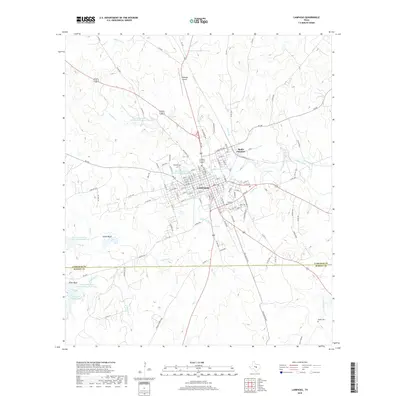
2019 Map of Lampasas
USGS Topo · Published 2019About this map
Lampasas serves as the central hub of this Central Texas landscape, where the confluence of water and rail historically shaped the community. The town's reliance on its natural resources is evident in the cluster of landmarks such as Gooch Spring, Swimming Pool Spring, and Hancock Springs, along with the course of Sulphur Creek. Transportation infrastructure is anchored by the Santa Fe rail line and the Lampasas Airport, while the surrounding terrain is defined by prominent elevations like Indian Bluff and Pillar Bluff.
Find a feature on this map
130 named features on this map. Tap any name to fly to it.
Don’t see what you’re looking for? This feature index may not catch every label — zoom into the map to look around manually.
Map Details
Editions of this 2019 Lampasas Map
This is the sole edition of this map. No revisions or reprints were ever made.
Other maps of this area

1887 · Lampasas
USGS Topo · 1:125,000

1887 · Burnet
USGS Topo · 1:125,000

1893 · Burnet
USGS Topo · 1:125,000

1894 · Lampasas
USGS Topo · 1:125,000

1903 · Burnet
USGS Topo · 1:125,000

1909 · Burnet
USGS Topo · 1:125,000

1932 · Tow
USGS Topo · 1:62,500

1954 · Brownwood
USGS Topo · 1:250,000

1954 · Lampasas
USGS Topo · 1:62,500

1954 · Lampasas
USGS Topo · 1:24,000