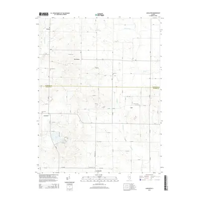
2015 Map of Lancaster
USGS Topo · Published 2015About this map
Helena and Petersburg anchor the northern landscape of this Lawrence County region, where the terrain is defined by the winding paths of Little Bonpas Cr and Storckman Cr. The map reveals a deeply rooted rural community, evidenced by the high density of family and community burial grounds such as Corrie Cem, Storckman Cem, and Moffett Cem. To the south, the settlement of Lancaster sits near the crossing of Jordan Cr, while the village of Friendsville marks the southern border. This area showcases a transition from traditional agricultural plots to recreational water features like Mesa Lake and Fish Lake. The boundary between Lawrence and Wabash counties bisects the quadrangle, illustrating how these local jurisdictions share the drainage basins of Crawfish Cr and Raccoon Cr.
Find a feature on this map
56 named features on this map. Tap any name to fly to it.
Don’t see what you’re looking for? This feature index may not catch every label — zoom into the map to look around manually.
Map Details
Editions of this 2015 Lancaster Map
This is the sole edition of this map. No revisions or reprints were ever made.
Other maps of this area

1901 · Princeton
USGS Topo · 1:62,500

1903 · Princeton
USGS Topo · 1:62,500

1903 · Patoka
USGS Topo · 1:125,000

1904 · Mount Carmel
USGS Topo · 1:62,500

1911 · Sumner
USGS Topo · 1:62,500

1913 · Sumner
USGS Topo · 1:62,500

1915 · Vincennes
USGS Topo · 1:62,500

1944 · Vincennes
USGS Topo · 1:62,500

1956 · Vincennes
USGS Topo · 1:250,000

1957 · Vincennes
USGS Topo · 1:250,000