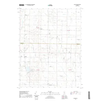
2018 Map of Lancaster
USGS Topo · Published 2018About this map
Lancaster and Friendsville anchor this southern Illinois landscape where the border between Lawrence and Wabash counties meets. The area is defined by a dense network of country roads, including Co Rd 1950 N and N 2050 Blvd, which link small agricultural hubs and numerous family cemeteries. These burial grounds, such as Corrie Cem, Moffett Cem, and Oreo Cem, suggest a deeply rooted rural genealogy. The terrain is drained by several meandering waterways including Little Bonpas Cr, Storckman Cr, and Crawfish Cr, which feed into local catchments like Mesa Lake and Fish Lake. Further north, the settlements of Helena and Petersburg serve as additional reference points for this well-ordered grid of section lines and townships, including t2n r13w and t1n r12w, illustrating the late-20th-century development of the region's rural infrastructure.
Find a feature on this map
44 named features on this map. Tap any name to fly to it.
Don’t see what you’re looking for? This feature index may not catch every label — zoom into the map to look around manually.
Map Details
Editions of this 2018 Lancaster Map
This is the sole edition of this map. No revisions or reprints were ever made.
Other maps of this area

1901 · Princeton
USGS Topo · 1:62,500

1903 · Princeton
USGS Topo · 1:62,500

1903 · Patoka
USGS Topo · 1:125,000

1904 · Mount Carmel
USGS Topo · 1:62,500

1911 · Sumner
USGS Topo · 1:62,500

1913 · Sumner
USGS Topo · 1:62,500

1915 · Vincennes
USGS Topo · 1:62,500

1944 · Vincennes
USGS Topo · 1:62,500

1956 · Vincennes
USGS Topo · 1:250,000

1957 · Vincennes
USGS Topo · 1:250,000