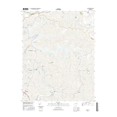
2016 Map of Lancer
USGS Topo · Published 2016About this map
Dewey Lake dominates the central landscape of this Floyd County region, its winding shoreline creating a complex series of inlets and ridges. To the west, the city of Prestonsburg serves as a primary hub, connected to the southern valley by the Levisa Fork river corridor. This waterway acts as a historical and modern artery for settlements such as Watergap, Lancer, and Dwale. The map reveals the intricate network of hollows that define the area's geography, including Prophet Hollow and Whiskey Hollow, which have long shaped local habitation patterns.
Find a feature on this map
100 named features on this map. Tap any name to fly to it.
Don’t see what you’re looking for? This feature index may not catch every label — zoom into the map to look around manually.
Map Details
Editions of this 2016 Lancer Map
This is the sole edition of this map. No revisions or reprints were ever made.
Other maps of this area

1886 · Prestonsburg
USGS Topo · 1:125,000

1892 · Prestonsburg
USGS Topo · 1:125,000

1914 · Laynesville
USGS Topo · 1:48,000

1914 · Inez
USGS Topo · 1:48,000

1915 · Paintsville
USGS Topo · 1:48,000

1915 · Prestonsburg
USGS Topo · 1:62,500

1916 · Harold
USGS Topo · 1:62,500

1916 · Inez
USGS Topo · 1:62,500

1917 · Paintsville
USGS Topo · 1:62,500

1918 · Prestonsburg
USGS Topo · 1:62,500