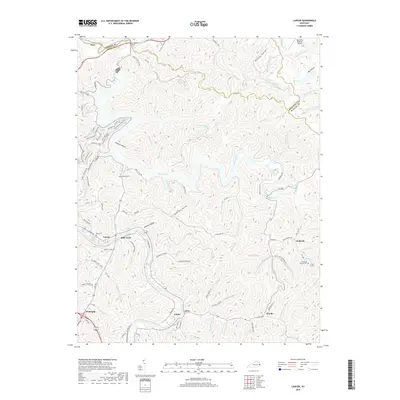
2019 Map of Lancer
USGS Topo · Published 2019About this map
Dewey Lake dominates the central topography of this eastern Kentucky landscape, where narrow valleys and sharp ridgelines dictate the patterns of settlement. Small communities like Lancer, Endicott, and Watergap are tucked along the winding creek beds, connected by a network of rural routes such as Charity Mountain Rd and Corn Fork Rd. The map reveals the intricate drainage system of the Big Sandy River basin, including Johns Creek and Bull Creek, which have carved out distinct hollows like Whiskey Hollow and Knotty Hollow. Local genealogy is well-served by the presence of several family and community landmarks, including Lockhart Cem, Mayo Cem, and the Endicott Church Cem. In the northwest, the Big Sandy Regional Airport stands as a modern transition in this largely rural terrain, while the trail systems around the lake, such as The Escalator and Switchback Loop Trail, highlight the recreational shift in the area's land use.
Find a feature on this map
121 named features on this map. Tap any name to fly to it.
Don’t see what you’re looking for? This feature index may not catch every label — zoom into the map to look around manually.
Map Details
Editions of this 2019 Lancer Map
This is the sole edition of this map. No revisions or reprints were ever made.
Other maps of this area

1886 · Prestonsburg
USGS Topo · 1:125,000

1892 · Prestonsburg
USGS Topo · 1:125,000

1914 · Laynesville
USGS Topo · 1:48,000

1914 · Inez
USGS Topo · 1:48,000

1915 · Paintsville
USGS Topo · 1:48,000

1915 · Prestonsburg
USGS Topo · 1:62,500

1916 · Harold
USGS Topo · 1:62,500

1916 · Inez
USGS Topo · 1:62,500

1917 · Paintsville
USGS Topo · 1:62,500

1918 · Prestonsburg
USGS Topo · 1:62,500