
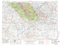
1955 Map of Lander
USGS Topo · Published 1976About this map
Lander serves as the gateway to the massive high-altitude terrain of the Wind River Range, where the Continental Divide separates the Pacific and Atlantic watersheds. The mid-century landscape is defined by its transition from the alpine peaks of the Shoshone National Forest and Bridger National Forest to the arid expanse of the Great Divide Basin and the Red Desert Country. Local industry is clearly visible through the development of the Beaver Creek Gas and Oil Field and the Steamboat Butte Oil Field, while the Oregon Trail remains a visible historical artery cutting across the southern half of the sheet. Regional infrastructure like the State Training School and several Historical Monuments near the Sweetwater River highlight the human footprint within the Wind River Indian Reservation and the surrounding ranching and mining country.
Find a feature on this map
152 named features on this map. Tap any name to fly to it.
Don’t see what you’re looking for? This feature index may not catch every label — zoom into the map to look around manually.
Map Details
Editions of this 1955 Lander Map
2 editions found
Other maps of this area

1907 · Gros Ventre
USGS Topo · 1:125,000

1909 · Fremont Peak
USGS Topo · 1:125,000

1910 · Gros Ventre
USGS Topo · 1:125,000

1937 · Moccasin Lake
USGS Topo · 1:48,000

1938 · Mt Bonneville
USGS Topo · 1:62,500

1939 · Big Piney
USGS Topo · 1:125,000

1941 · Mt Bonneville
USGS Topo · 1:62,500

1942 · Big Piney
USGS Topo · 1:125,000

1942 · Mt Bonneville
USGS Topo · 1:62,500

1943 · Moccasin Lake
USGS Topo · 1:62,500