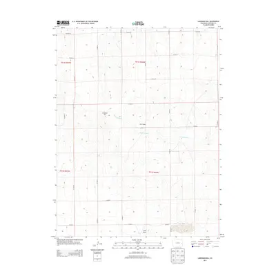
2013 Map of Landsman Hill
USGS Topo · Published 2013About this map
Smoky Hill River meanders through the central corridor of this eastern Colorado landscape, defining the local drainage patterns and topography. The terrain is punctuated by distinctive natural landmarks such as Landsman Hill and the prominent Agate Mound to the south. Historically significant features like Ute Canyon offer a glimpse into the geographic markers used by early inhabitants and travelers in Cheyenne County. The map reveals a highly structured grid of rural infrastructure, dominated by a series of numbered section lines and lateral routes like Co Road DD and Co Road Z. This network illustrates the systematic land division of the High Plains, where remote ranching and agricultural access are facilitated by these critical county roads. The drainage of Cow Cr in the northern portion of the quadrangle further emphasizes the importance of sparse water resources in this arid environment.
Find a feature on this map
16 named features on this map. Tap any name to fly to it.
Don’t see what you’re looking for? This feature index may not catch every label — zoom into the map to look around manually.
Map Details
Editions of this 2013 Landsman Hill Map
This is the sole edition of this map. No revisions or reprints were ever made.
Other maps of this area

1891 · Kit Carson
USGS Topo · 1:125,000

1892 · Cheyenne Wells
USGS Topo · 1:125,000

1893 · Kit Carson
USGS Topo · 1:125,000

1894 · Cheyenne Wells
USGS Topo · 1:125,000

1954 · Limon
USGS Topo · 1:250,000

1954 · Lamar
USGS Topo · 1:250,000

1957 · Limon
USGS Topo · 1:250,000

1958 · Limon
USGS Topo · 1:250,000

1958 · Lamar
USGS Topo · 1:250,000

1969 · Alpine Ranch
USGS Topo · 1:24,000