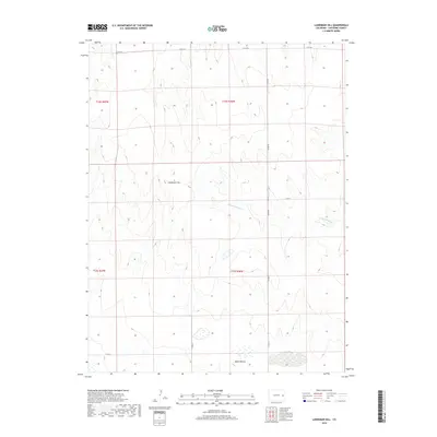
2019 Map of Landsman Hill
USGS Topo · Published 2019About this map
Smoky Hill River meanders across this High Plains landscape in Cheyenne County, following a shallow valley that defines the local topography. This 2019 survey captures the area's sparse, rural character, where large-scale land divisions are marked by a grid of county roads including Co Rd Dd and Co Rd 34. Distinctive relief features rise above the surrounding terrain, most notably Landsman Hill in the central portion of the quadrangle and Agate Mound to the south. The drainage patterns are further articulated by seasonal watercourses like Coon Cr, which feeds into the larger river system. This map illustrates the persistence of the Public Land Survey System in eastern Colorado, showing the township and range boundaries that have organized this ranching and agricultural region for generations.
Find a feature on this map
13 named features on this map. Tap any name to fly to it.
Don’t see what you’re looking for? This feature index may not catch every label — zoom into the map to look around manually.
Map Details
Editions of this 2019 Landsman Hill Map
This is the sole edition of this map. No revisions or reprints were ever made.
Other maps of this area

1891 · Kit Carson
USGS Topo · 1:125,000

1892 · Cheyenne Wells
USGS Topo · 1:125,000

1893 · Kit Carson
USGS Topo · 1:125,000

1894 · Cheyenne Wells
USGS Topo · 1:125,000

1954 · Limon
USGS Topo · 1:250,000

1954 · Lamar
USGS Topo · 1:250,000

1957 · Limon
USGS Topo · 1:250,000

1958 · Limon
USGS Topo · 1:250,000

1958 · Lamar
USGS Topo · 1:250,000

1969 · Alpine Ranch
USGS Topo · 1:24,000