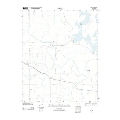
2010 Map of Lane
USGS Topo · Published 2010About this map
The settlement of Lane serves as a primary reference point in this corner of Atoka County, where the landscape is defined by the extensive drainage systems of Muddy Boggy Creek and its many tributaries. The area exhibits a complex network of waterways, including the winding Wilson Creek and the bifurcated Double Springs Creek, which carve through the terrain near Cat Hollow and Negro Bend. This 2010 survey illustrates a rural Oklahoma environment where section-line roads like n3970 RD and E 1850 RD provide access to scattered homesteads and points of local interest.
Find a feature on this map
41 named features on this map. Tap any name to fly to it.
Don’t see what you’re looking for? This feature index may not catch every label — zoom into the map to look around manually.
Map Details
Editions of this 2010 Lane Map
This is the sole edition of this map. No revisions or reprints were ever made.
Other maps of this area

1899 · Atoka
USGS Topo · 1:125,000

1900 · Atoka
USGS Topo · 1:125,000

1901 · Antlers
USGS Topo · 1:125,000

1912 · Antlers
USGS Topo · 1:125,000

1925 · Antlers
USGS Topo · 1:125,000

1950 · Mcalester
USGS Topo · 1:250,000

1956 · Stringtown
USGS Topo · 1:24,000

1957 · Lane NW
USGS Topo · 1:24,000

1957 · Farris
USGS Topo · 1:24,000

1957 · Bruno
USGS Topo · 1:24,000