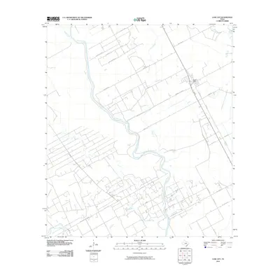
2010 Map of Lane City
USGS Topo · Published 2010About this map
Lane City serves as the central hub of this coastal prairie landscape in Wharton County, where the meandering Colorado River dictates the layout of local roads and property boundaries. The terrain is defined by a complex network of waterways, including Jarvis Creek, Jones Creek, and the East Fork of Blue Creek, suggesting a region heavily influenced by drainage and irrigation. Infrastructure for local agriculture and water management is evident through features like Pumping Station Rd. Large tracts of land, such as those accessed via Pierce Ranch Rd, indicate the historical and economic importance of ranching in this part of Texas. From the north at Cherry Loop to the southern reaches near Hollywood Rd, the map reveals a landscape where rural development is closely tied to the bends of the river and its numerous tributaries.
Find a feature on this map
32 named features on this map. Tap any name to fly to it.
Don’t see what you’re looking for? This feature index may not catch every label — zoom into the map to look around manually.
Map Details
Editions of this 2010 Lane City Map
This is the sole edition of this map. No revisions or reprints were ever made.
Other maps of this area

1950 · Houston
USGS Topo · 1:250,000

1951 · Danevang
USGS Topo · 1:24,000

1952 · Lane City SE
USGS Topo · 1:24,000

1952 · Pledger
USGS Topo · 1:24,000

1952 · Lane City
USGS Topo · 1:24,000

1952 · Van Vleck
USGS Topo · 1:24,000

1952 · Pierce
USGS Topo · 1:24,000

1953 · Wharton
USGS Topo · 1:24,000

1953 · Glen Flora
USGS Topo · 1:24,000

1953 · Boling
USGS Topo · 1:24,000